
This is my third map for the popular 5e mini adventure, "White Plume Mountain" from the book "Tales from the Yawning Portal," published by Wizards of the Coast. I'll publish more encounter maps for this dungeon as I complete them, so stay tuned.
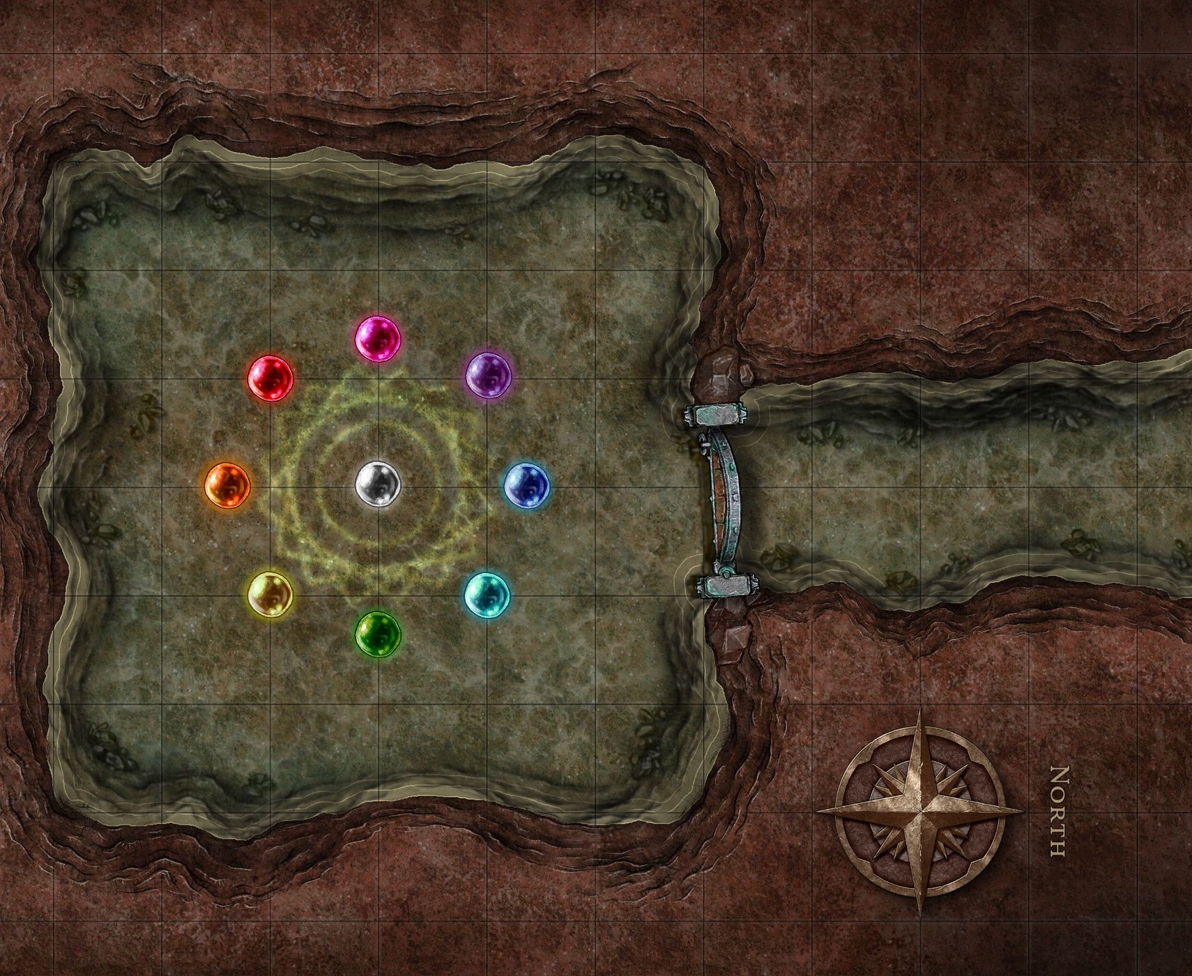
This map shows area #4, "Glass Globes." As with much of this dungeon, this area is flooded with a foot of water. In this scene, there are nine glass globes hanging from the ceiling - I arranged them in a circle rather than a grid just to make it look more interesting. I also added a glowing arcane circle design on the floor and used a filter to make it look like it's under the water - it's still an object though so you can delete it if you wish. (The book never actually says how the globes are arranged beyond the fact that they're hanging from the cavern ceiling.)
All parts of the map are editable with almost nothing flattened into the layers - unlock the objects in the right hand menu to edit. If you want to use a different water or rock texture, just paint the background with your water color and the foreground with your rock texture - the cliffs will assimilate into your new colors.
This map is 9 x 11 inches if kept at the proper scale - it's a good size for desktop printing if you crop half an inch off to make it 8.5 x 11 inches.
PRINTING TIPS:
The bitmap image you get when you export a map from Inkarnate will probably not print out at the proper scale if you try to print it from a photo-editing program like Photoshop. You should import it into desktop publishing software like CorelDRAW, Adobe Illustrator, etc. Free desktop publishing software is available, and I assume it would work too. Desktop publishing software allows you to control exactly how large an imported bitmap will print, allowing you to stretch the bitmap without "resampling" it (which can make the image blurry). Obviously, unless you have a large format printer, you'll have to crop the map into four quarters so they'll fit onto four sheets of printer paper. From the desktop publishing software, I like to export my map pages into printer-friendly .pdf files.